 Approximately 16 1/2 Million people reside in Chile, where a major earthquake struck today. Chile stretches over 4,300 km (2,700 mi) along the southwestern coast of South America, a distance roughly the same as that from San Francisco to New York. At the same time, its width never exceeds 240 km (150 mi), making the country more than eighteen times longer than its widest point. The Map of Chile shows the unusual shape of the country as it hugs the Pacific coast.
The Pacific forms the country's entire western border, with Peru to the north, Bolivia to the northeast, Argentina to the east, and the Drake Passage at the country's southernmost tip. The Andes Mountains separate Chile from the rest of South America. Chile claims 1,250,000 km² of territory in Antarctica.
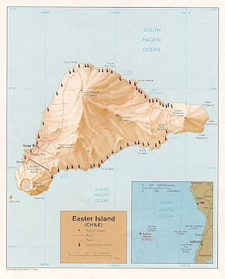
Also part of Chile are two notable Pacific possessions-the Juan Fernandez Islands and the famous Easter Island, both of which are administered as national parks. The Juan Fernandez islands are located about 670 km off the Chilean coast, while Easter Island is situated 3700 km distant.
- Chile Geography and People >
- Chile Wikipedia >


No comments:
Post a Comment