 BHUBANESWAR: After its role in managing natural resources, disaster management and more recently of malaria in the State, geo-information system (GIS) applications have come as a great help in another key area of wildlife management, i.e. reducing man-animal conflicts.
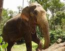
As per a study by Chandaka Dampara Sanctuary authorities, the movement pattern of specific elephants, its flagship species, can now be known through proper GIS mapping over the years with the help of annual and seasonal data interpretation so that the elephant depredation can be predicted and managed properly with the help of the villagers of the periphery areas.
Though it is still at a preliminary stage, the month-wise flow of elephant movements out of the sanctuary in co-ordination with different parametres like cropping pattern and water availability inside the sanctuary and their co-relations can be found out from the GIS study, says DFO Akshaya Kumar Pattnaik.
Explaining one such parameter like the least disturbing time of the sanctuary, ie. rainy season and the most disturbed period, ie. winter or post-harvesting season, according to elephant point of view, he says that the disturbances created by biotic pressure (human beings) after the harvesting season causes another major concern.
Inhabitants of the periphery villages go to forest for firewood collection, non-timber forest products and use the area for grazing their cattle and these activities after January are incorporated in the GIS mapping process.
1 comment:
Using GIS to track elephant movements in National Parks nad Sanctuaries is a welcome development. Knowing in advance about the movement patterns can help reduce human elephant conflict.
Post a Comment