Tuesday, June 20, 2006

Burj Dubai - Tallest Skyscraper Webcam

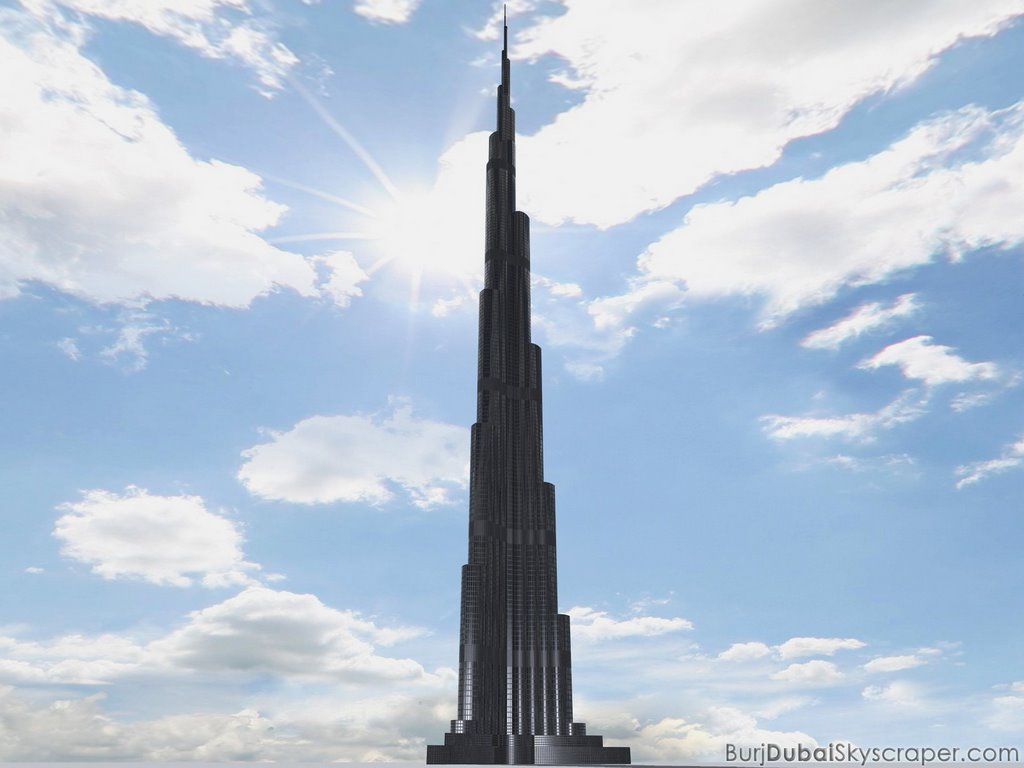
Although it's still a year away from being completed, the Burj Dubai, the soon to be world's tallest skyscraper, is taking shape. They have an aggressive website that updates the buildings height as well as skyscraper news around the world, namely other buildings trying to claim the world's tallest title. A new outline of the building is highlighted in red with the building progess and a webcam updates pictures of the construction. 3-D renderings of the site plan and skyline are an added feature.

Also, a GIS site for Dubai is up but not operational yet. I have posted a link on www.gispilot.com under the "World Countries" section. The same message has been up for a month now and I do not know when it will be operational. However, the link is there for your other mapping needs on Dubai.

On the web:

Burj Dubai Skyscraper

www.GisPilot.com

Friday, June 16, 2006

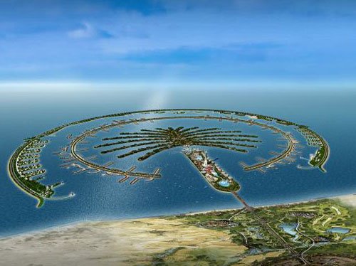
Satellite images of Dubai & The Palm (Island of sand)

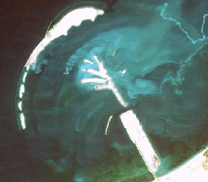
Satellite image of The Palm

The Palm has updated their website to include new photos as their construction takes shape. The Palm can be summed up as a man made subdivision in the shape of a palm tree. The trick is that it's built in the Persian Gulf using sand.

Click for hi-res: you can see the dredgers at work building the island.

During the construction

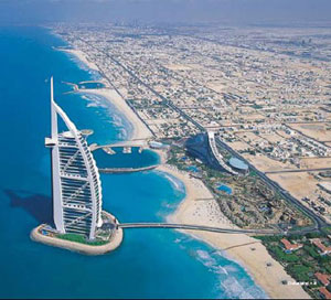
Burj-al-arab Hotel

Click for hi-res - Burj-al-arab Hotel

Dubai's goal is to be the recreation site of the world. The World's largest skyscraper are being built here as well as the World's largest man-made islands, like the Palm. So far, popularity is so high that there are islands being built in the shape of the world as well as another, larger palm tree with leaves. (See Previous Post: Livin' in a Palm tree in Dubai!) The Burj-al-Arab hotel is considered the finest in the world, offering a private and spoiled stay in a hotel built in the Gulf. The hotel was built in 1999 and the design is modeled after a sail from a boat as it catches the wind. Rates start at about $1,000/night and it is considered the only 7-star hotel. Yes, it's so fancy they made more stars on the rating system to accommodate it. There are plans in Dubai for an underwater hotel, theme parks, and various other skyscrapers.

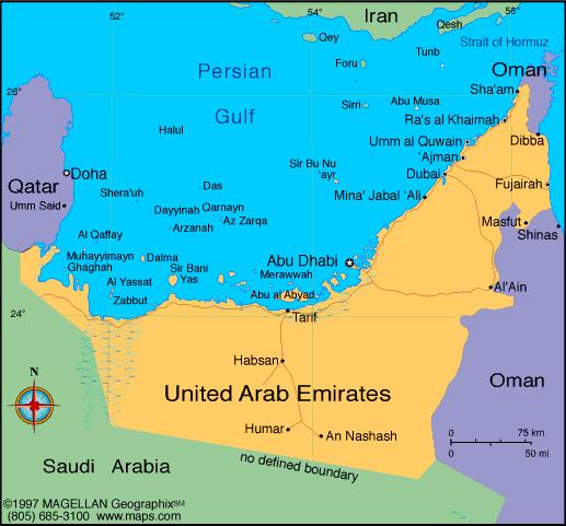
Dubai-UAE

Wednesday, June 14, 2006

World Cup Stadiums 3

Germany 2006 World Cup Stadiums Satellite Images Part 3 up at WWW.GISPilot.com/blog

Hurricane simulator.

It's that time of year again when the Atlantic Ocean starts up trouble. This year marks the first wave of storms since last years tragic hurricanes that swept through the south. For those that would like to know what the scales mean and how the react to the environment (and your house), I have found a hurricane simulation.

Tuesday, June 13, 2006

Stadium pics and Satellite photos #2 for GERMANY 2006 WORLD CUPS STADIUMS up at WWW.GISPILOT.COM/BLOG

(Blogger's being difficult, so they're being posted there for the time being)

Monday, June 12, 2006

World Cup 2006 Germany - Stadiums and GIS.

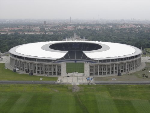
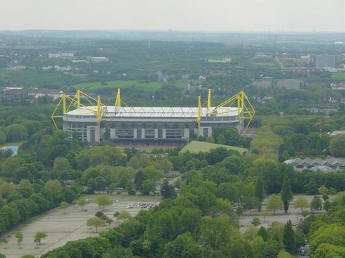
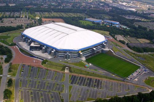
The 2006 FIFA World Cup has started in Germany and to help those who cannot make the trip to Europe, I have gathered a list of the stadiums, with pictures, and added some Satellite images for fun (just click on their highlighted names for Satellite images) So, here part 1 of 4 of the 12 stadiums being used for the World Cup.

  • Olympiastadion, Berlin, Germany. The history of this stadium is unparalleled in world sports. It was at this venue that Jesse Owens gave an athletic bitch-slap to the Nazis and Adolph Hitler by winning at the 1936 Berlin Olympics. The final match for the 2006 FIFA World Cup will be held here and holds 72,000 fans.

  • Dortmund Westfalenstadion. Dortmund is known for its eight 62-metre-high bright yellow support pylons that stand out from miles away. It holds 65,000 fans and is known nationwide as the Bundesliga’s (German Football League) opera-house.

  • FIFA World Cup Stadium Gelsenkirchen (Gelsenkirchen Arena Auf Schalke). The 2002 World Cup brought a new group of fans to the World Cup when is was staged in Asia for the first time. Also, a new interest in newer, fancy stadiums came about due to rising interests and new technologies over the last 10 years. Here some of the new features in stadium architecture are being illustrated. Namely a giant video cube scoreboard, a retractable roof, and the field is retractable and goes outside for sun and air. The stadium officially opened in August, 2001, and holds 52,000 fans.

Thursday, June 08, 2006

GIS Pilot Blog now Up.

The transition of the Blog from this site to www.GISPilot.com/blog has begun. The links are not yet present, but should be up within a week. Blogger is a constant headache, being up and down like a pogo stick the last few weeks. So, the wordpress blog at WWW.GISPilot.com will be more reliable.

Wednesday, June 07, 2006

Back by Popular Demand - Hasselhoff Paper Airplane.

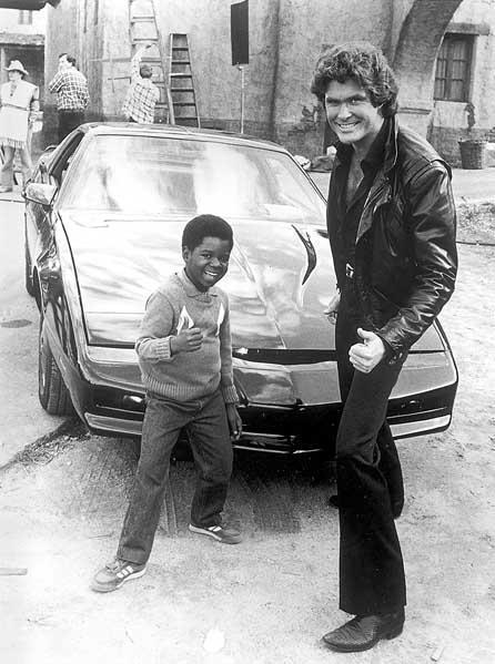
Greatest Picture Ever

He's back.

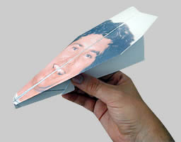
Nothing about GIS, but who could resist a David Hasselhoff Paper Airplane. I have officially tested the process and I am here to say it works! You can be flying a paper airplane around your office in 5 minutes. A good time waster! It's from a site called the Knight Foundation which states its website is: "The Offical David Hasselhoff Site of Worship. A site dedicated to the memory of David Hasselhoff's hair!"

Click here for the Knight-Foundation David HasselHoff Paper Airplane!

India vs. Google Earth.

Suprise!
Privacy laws are coming to a head in India as President A.P.J. Abdul Kalam demanded new laws to restrict the eyes of satellites above to be used on the web, namely Google Earth. Interesting to find out how far up in space a territory has the rights to. It's another debate for the ages as privacy rights of governments are challenged by the public.
The big debate a few years ago was when Area 51, the U.S. Government secret airbase, was published on the web as satellite photos. The U.S. declared rights of privacy for secrets of the state, while public institutions demanded that if U.S. funds from taxpayers were being used to run the site then the public had a right to know information.
Hmmm.
Anywho, Area 51 is now on the web and Google Earth has updated there pics here.

Hurricane Mapping Program.

Antarctic Ice Flow Tunnel
Thanks to Jason @ Florida GIS Data Blogspot for the heads up on this: IBISEYE.com is still in its beta version, but the program is solid and valuable to anyone needing Hurricane data, both current and past. The amount of time and effort put into this site shows with the details in data and presentation. Also, with hurricane season approaching fast, this site will definitely be making the rounds of websites. Also, there a new way to "look" into storms with satellites. Live Science.com reports: "NASA's new CloudSat satellite reveals never-before-seen details of both the clouds and precipitation within a storm, from the Earth's surface to 19 miles high." Click here for IBISEYE.com Homepage. Click here for LiveScience.com article on new Satellite.

Google Active Volcano Maps!

Google Maps are starting to make a name for themselves for their creative aspects. Check out this map of the world's active volcano's. Click on the satellite button when you find the 'pin' you want to see.

Click here for Volcano Map

Geocoding gone wrong!

There seems to some people near Memphis who live inbetween zip codes who have not had to pay vehicle registration fees for many years. Now, the city is using GIS to track them down for the money. Oops!
Here's a brief exclamation on what happened:
The City of Memphis has "found" more than 3,000 residents who haven't been paying to register their vehicles in the city, and now officials are searching for more.
Many of the targeted households are in Zip Codes that are split between two municipalities or between a city and an unincorporated area.

Tuesday, June 06, 2006

Monday, June 05, 2006

Geography of Sports - Stanley Cup 2006

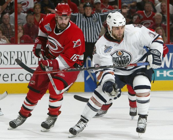
Ahhh, the Stanley Cup Finals are back. If were lucky enough to catch Game 1 on Monday, you witnessed a wall-to-wall offensive explosion. (See previous post on Semi-Finals here.) So, it's the Edmonton Oilers vs. the Carolina Hurricanes. They hit hard and score at will. There, you're caught up. Now, onto the fun. The game featured all the twist and turns you would expect from a evenly matched Finals. Unfortunately, Oilers goalie Dwayne Roloson (A.K.A.- The savior of Edmonton) went down late in the 3rd period and didn't return. That could easily alter my prediction of the Oilers in 6 for the Cup. With Carolina scoring with 31 seconds left to win, this was a game for the ages.

Anyway, if you are not a die-hard fan, here's some GIS and stuff about the teams.

Most people know Edmonton, if at all, for two things: Wayne Gretzky and the West Edmonton Mall.(Click for Satellite Image). Wayne Greztky (Click here for his website) is the best hockey player in NHL history and the West Edmonton Mall is the World's Largest Mall. (Click here for West Edmonton Mall Website). Sorry, Mall of America, you're only the biggest in the United States.

The Oilers play in the Rexall Place in Edmonton (Click for Satellite Image), Alberta, Canada. It used to be the called the Northlands when Gretz played, but they sold the rights to Rexall, a drug maker in Canada.

I have added the GIS site for Edmonton, Alberta. It uses an Adobe SVG tool that you might have to download, but it's not too big. (Click here for Edmonton, GIS)

Here's a few facts from Edmonton from their main website: The City of Edmonton encompasses a land area of 700 square kilometers, with a population of 712,391 based on the 2005 Civic Census. It is the hub of Canada's sixth largest Census Metropolitan Area with a current population estimated at 1,014,000.

Carolina won game 1. The Hurricanes moved to Raleigh, North Carolina in 1997 after moving from Hartford, Conn. There they were known as the Hartford Whalers and never made the Stanley Cup Finals even with Gordie Howe on their line. Now, they are in their 2nd Stanley Cup Finals, after losing to Detroit in 2001-2002.

They play now in the RBC Center along with the NC State Wolfpack. (Click here for Satellite Image of the RBC Center.)
Intermittent explosive disorder - New trendy problem.

This following article has nothing to do with GIS or Geography. It was just interesting and with all the people I see on the road today, I thought I'd pass it on. There's finally a diagnosis for having Road Rage. It's called "intermittent explosive disorder," or IED. Yes, it has an acronym. It was bound to happen and I'm sure soon we'll be seeing those really long, ambiguous commercials promoting some medicine for a cure. Of course side effects include blindness, headaches, constipation.... Here's how a 16 year old boy with IED acts: "In most situations, he is relatively affable, calm and very responsible," she said. But in stressful situations at home, he "explodes and tears apart his room, throws things at other people" to the point that his parents have called the police." I wonder how long before you can get insurance for being a jerk or a brat?

Do you want to play a Game?

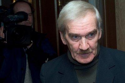
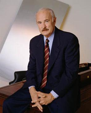
Remember "WAR GAMES," that movie from 1983 with a squeeky Matthew Broderick where a supercomputer starts a simulation of nuke warfare? Well, Moscow.news is claiming it happened for real and here's the man who stopped it. Funny, he doesn't look like Matthew Broderick! A little like Dabney Coleman, though.

Sunday, June 04, 2006

Geography Quiz and results of American Students.

Take this geography quiz from AOL. It's not hard and the actual quiz is not so much the point of the process. Instead, after you answer the questions, there are results of how our young, American students did on geography tests. The results are not good.

Thursday, June 01, 2006

GIS and Archaeology.

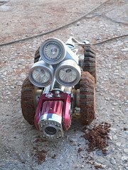
Matt at GISArch.com has created a unique site for GIS and Archaeology. This neat mix of the 2 sciences is displayed at his site and here's a link to his article on the Archaeology of a 1945 Prison Escape Tunnel and the use of an "Electric Eel" camera on wheels. Neat. This article is part 2 and the technical stuff, so head over and read part I to catch up.