 Over the course of the week, Israel has taken aggressive actions against hostile forces in the Middle East. While I was compiling maps and images for a post I found a great site with all the information I needed at the Israel Science and Technology webpage. They have a great selection of satellite images, some of which I posted below. Their maps section link up to some great maps of Israel as compared to the rest of the Middle East and some decent animated maps of Biblical nature.
 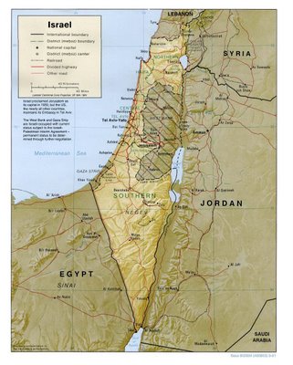 Also, this site at Athaia.com has an extensive selection of Middle East maps, not just Israel. They have some high-quality scans that really show the details, which sometimes can be hard to find in online scans.
Resources:
Athaia Maps
Israel Science & Technology
Also, this site at Athaia.com has an extensive selection of Middle East maps, not just Israel. They have some high-quality scans that really show the details, which sometimes can be hard to find in online scans.
Resources:
Athaia Maps
Israel Science & Technology 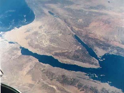 Satellite Image of Sinai Desert

Israel & Egypt light up the Middle East
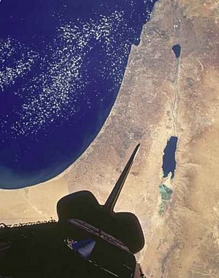
Space Shuttle Looks Down on Israel.
No comments:
Post a Comment