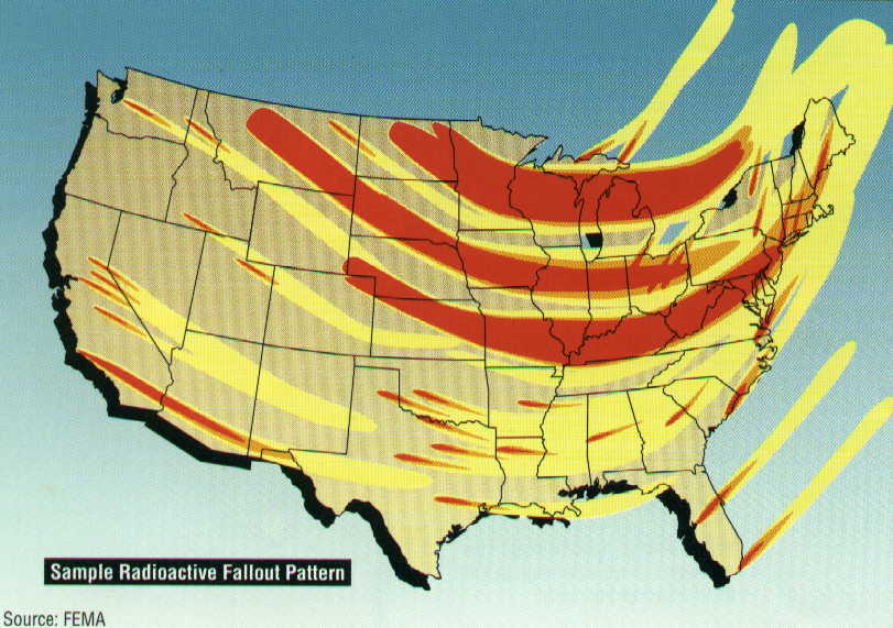
 Fallout Map
 Tennessee Nuclear Attack Blast Map
By accident, I came across this site while looking for a subdivision in Missouri. It's a Nuclear Survival Resource site with nuclear fallout maps and blast radius maps. Bruce Beach is the author and is trying to build some kind of survival ark (ARK II) for survivors of a nuclear fallout/winter. The guy has put some effort into either creating maps or just lifting all the graphics from someone else. I'm not sure on that , but I thought it was interesting to look at. Personally, I'm not too worried about the paranoid aspect of the site, but after living in Montana for many years, I am well aware of the nuclear fallout from testing done in Nevada during the Cold War and the risk of lymphoma.
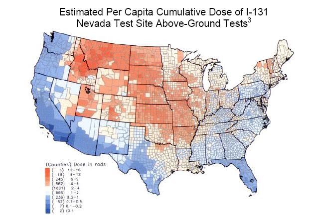
So, switching gears, I was able to find the fallout maps and rates of thyroid cancer in the United States linked to military nuclear testing during the Cold War years, roughly 1951-63. There are many links to the 1997 report, but here is one with the map.
The basic thing was that radiation from the testing was deposited in the areas above at higher than normal levels and instituted into the environment. One of the main issues are with people who lived in these areas where Moo-Cows ate the bad grass and the milk was tainted and consumed by people like me. Let's just say there are sorta high rates of Thyroid cancer in these areas. Anyway, check out the maps and data and below I have included some related links on the matter. Downwinders.ORG has the most up to date info and articles on the subject of nuclear power/weapons across the world.
- Downwinders.ORG (great site for anyone living in the area)